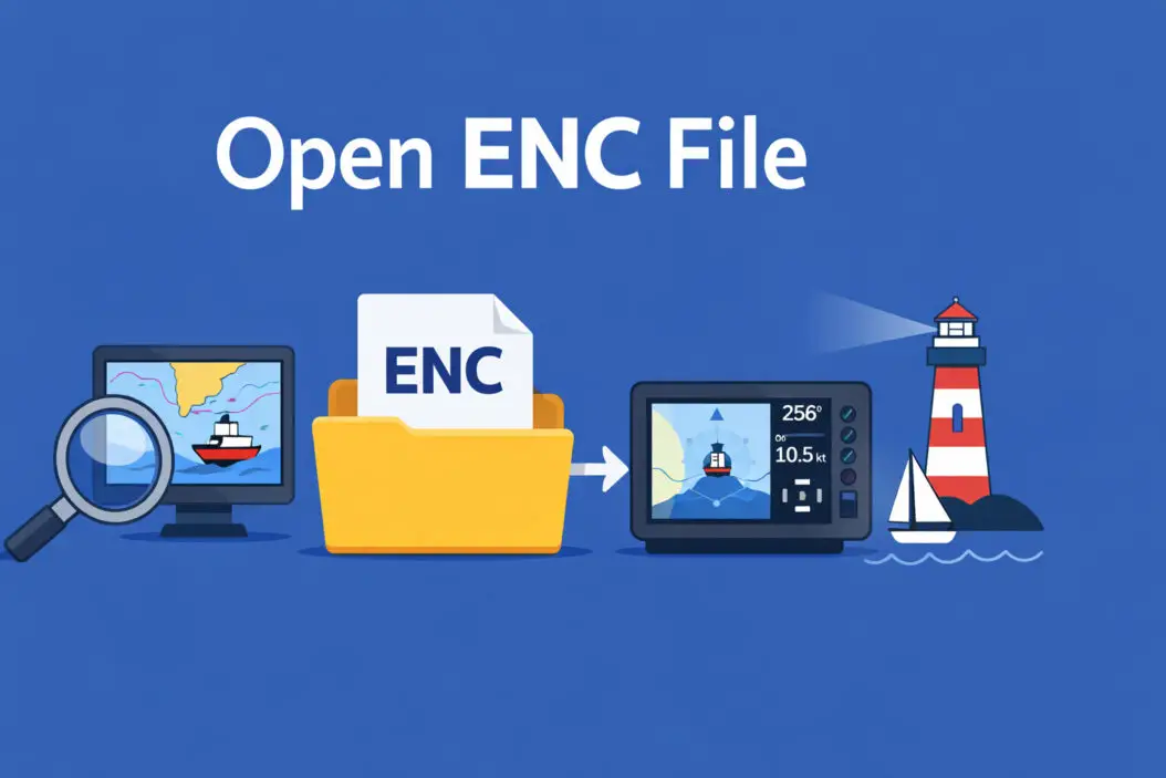
You’ve downloaded an ENC file and can’t figure out how to open it. I’ll show you exactly what these files are and walk you through every method to access them.
What Is an ENC File?
An ENC file is an Electronic Navigational Chart, a digital map used primarily for marine navigation. These files contain detailed information about water depths, coastal features, harbors, and navigational hazards. Ship captains, maritime professionals, and recreational boaters rely on ENC files for safe navigation.
The International Hydrographic Organization (IHO) standardizes these files using the S-57 format. This ensures that navigation software worldwide can read and display the data correctly.
Quick answer: You need specialized marine navigation software to open ENC files. The most common programs include OpenCPN (free), SeaClear, or commercial options like MaxSea and Coastal Explorer.
Understanding ENC File Format
ENC files store vector-based geographic data rather than simple images. This means the chart information is dynamic and can be layered, zoomed, and customized based on your needs.
Here’s what makes ENC files different from regular map files:
Data structure: The file contains multiple layers including depth contours, buoys, lighthouses, restricted areas, and underwater features.
File extensions: You’ll typically see .000 or .001 extensions. Some ENC files come in compressed formats or within encrypted containers for licensing purposes.
Coordinate system: These files use precise latitude and longitude coordinates based on the WGS84 datum, ensuring accuracy for navigation.
Methods to Open ENC Files
Method 1: Using OpenCPN (Free and Recommended)
OpenCPN is open source navigation software that works on Windows, Mac, and Linux. This is your best free option.
Step 1: Download OpenCPN from the official website. Choose the version matching your operating system.
Step 2: Install the software following the standard installation process.
Step 3: Launch OpenCPN and go to Options (wrench icon or F5 key).
Step 4: Navigate to the Charts tab.
Step 5: Click “Add Directory” and browse to the folder containing your ENC files.
Step 6: Enable “Scan Charts and Update Database.”
Step 7: Click OK. OpenCPN will process the files and display them on the chart interface.
Step 8: Use the chart bar on the right side to select which ENC chart you want to view.
The software automatically handles the S-57 format and renders the navigational data properly. You can zoom, pan, and toggle different information layers.
Method 2: SeaClear Navigation Software
SeaClear offers both free and paid versions for Windows users.
For the free version:
Download SeaClear II from their website. Install and open the program. Click File, then Chart Catalogs. Add your ENC file directory. The software will import and display your charts.
For better performance: The paid version includes additional features like route planning and real-time GPS integration, but the free version handles ENC viewing perfectly.
Method 3: Commercial Marine Software
Professional mariners often use these paid options:
MaxSea TimeZero: Industry standard for commercial vessels. Supports ENC files with advanced routing and weather overlay features.
Coastal Explorer: Popular among recreational boaters. Excellent interface with straightforward ENC integration.
Expedition: High-end racing and cruising software with comprehensive ENC support.
Nobeltec: Long-established navigation software trusted by professionals.
These programs cost between $200 and $2,000 depending on features and licensing.
Method 4: Converting ENC Files
Sometimes you need to convert ENC files to more accessible formats.
Using GDAL (Geographic Data Abstraction Library):
This free tool converts between geospatial formats. You can transform ENC files into GeoTIFF, KML, or other formats that standard GIS software can read.
Download GDAL from OSGeo. Use the ogr2ogr command-line tool with this syntax:
ogr2ogr -f "KML" output.kml input.000
This converts your ENC file to KML format, viewable in Google Earth.
Important limitation: Converting ENC to image formats loses the dynamic, layered nature of the original data. You’ll see the chart, but you can’t interact with individual features or adjust display settings.
Where to Get ENC Files
Official Sources
NOAA (United States): The National Oceanic and Atmospheric Administration provides free ENC downloads for US waters through their Office of Coast Survey.
UKHO (United Kingdom): The UK Hydrographic Office sells AVCS (Admiralty Vector Chart Service) data for worldwide coverage.
Primar: Norwegian company distributing ENC data from multiple hydrographic offices globally.
IC-ENC: International Centre for ENCs distributes official chart data from participating nations.
Regional Hydrographic Offices
Most maritime nations maintain their own hydrographic services that produce ENC files for their territorial waters. Examples include:
The Australian Hydrographic Office Service Hydrographique et Océanographique de la Marine (France) Bundesamt für Seeschifffahrt und Hydrographie (Germany) Servicio de Hidrografía Naval (Argentina)
Common Problems and Solutions
| Problem | Cause | Solution |
|---|---|---|
| File won’t open | Wrong software | Use marine navigation software, not general file viewers |
| Charts appear blank | Incorrect file path | Verify ENC files are in the directory you specified |
| Missing depth data | Incomplete download | Re-download the complete ENC cell |
| Licensing error | Encrypted charts without permit | Purchase valid license or use free NOAA charts |
| Corrupted display | Outdated software | Update to latest version of your navigation program |
| Wrong coordinates | Datum mismatch | Ensure software uses WGS84 datum |
Troubleshooting Encrypted ENC Files
Some commercial ENC files come with copy protection. You’ll need:
User permit: A file (usually .permit extension) that unlocks the charts.
Installation key: Provided when you purchase the charts.
Cell permit: Authorizes specific chart cells for a time period.
Place permit files in the same directory as your ENC files. The navigation software will automatically detect and apply them.
ENC vs. Other Chart Formats
Understanding the differences helps you choose the right charts:
ENC vs. RNC (Raster Navigational Charts):
RNC files are scanned paper charts. They look familiar but offer less functionality. ENC files provide dynamic data you can customize. Professional vessels must carry approved ENC charts for compliance with SOLAS (Safety of Life at Sea) regulations.
ENC vs. KAP/BSB charts:
These raster formats are common in recreational boating software. They’re easier to view without specialized software but lack the intelligent features of vector ENC data.
ENC vs. CM93:
CM93 is an older vector format. Most modern software supports both, but ENC is the current international standard.
Legal and Safety Considerations
Navigation responsibility: ENC files are tools, not replacements for proper seamanship. Always maintain paper chart backups and verify electronic data.
Chart updates: Navigational hazards change. Sunken vessels, new buoys, and depth changes require regular chart updates. Subscribe to update services or check for new editions regularly.
Official vs. unofficial charts: Only official ENCs from recognized hydrographic offices meet legal requirements for commercial vessels. Verify your charts come from legitimate sources.
Copyright: ENC files are copyrighted. Sharing commercial charts violates international copyright law. Use free sources like NOAA or purchase proper licenses.
Advanced ENC Features
Once you’ve opened ENC files, explore these capabilities:
Layering control: Toggle visibility of different feature types. Hide shallow water areas or highlight navigation aids.
Depth shading: Set custom safety depths. The software highlights areas shallower than your vessel’s draft.
Text information: Click objects to read detailed notes about lights, buoys, and hazards.
Route planning: Professional software lets you plot routes that automatically avoid shallow water based on ENC depth data.
Tidal information: Some programs overlay tidal predictions on ENC charts.
AIS integration: Connect to Automatic Identification System receivers to see other vessels on your ENC chart.
Mobile Options for ENC Files
Navionics: Mobile app (iOS and Android) that supports proprietary chart formats. Some versions import standard ENC files.
OpenCPN on tablets: Android version available through Google Play. Performance varies by device.
iNavX: iOS navigation app with ENC support through additional purchases.
Coastal Explorer Mobile: Companion app to the Windows version.
Mobile devices work well for route planning and reference, but dedicated plotters remain superior for active navigation due to screen brightness, weatherproofing, and reliability.
System Requirements
Minimum specifications for ENC software:
Processor: Dual-core 2.0 GHz or better RAM: 4 GB minimum, 8 GB recommended Storage: 500 MB for software, plus space for chart files (10 MB to 5 GB per region) Display: 1280×720 resolution minimum Operating system: Windows 10/11, macOS 10.13+, or Linux (Ubuntu 18.04+)
For optimal performance:
Dedicated graphics card helps with smooth panning and zooming. SSD storage speeds up chart loading. Multiple monitors let you display different zoom levels simultaneously.
File Management Tips
Organize by region: Create separate folders for different cruising areas. This speeds up chart loading and makes updates easier.
Backup your charts: Store copies of purchased ENC files and permits on separate drives or cloud storage.
Track updates: Keep a spreadsheet noting when you downloaded each chart cell. This helps identify which charts need refreshing.
Delete old editions: Don’t mix outdated and current charts in the same directory. Archive old versions separately if you want to keep them.
Summary
Opening ENC files requires specialized marine navigation software because these aren’t standard document or image files. OpenCPN provides the best free solution for most users, while commercial options offer advanced features for professional mariners.
Download your chosen software, point it to your ENC file directory, and let it process the charts. The software handles the technical details of parsing the S-57 format and rendering the navigational data.
Remember that ENC files are professional tools for navigation. Take time to understand the information they present, keep them updated, and use them alongside traditional navigation skills for safe passage.
Frequently Asked Questions
Can I open ENC files in Google Earth?
Not directly. You must first convert ENC files to KML format using tools like GDAL. This conversion loses the dynamic, layered features that make ENC files valuable. The converted file becomes a static image overlay rather than interactive navigational data. For actual navigation purposes, use proper marine software instead.
Are all ENC files free to download?
No. NOAA provides free ENC coverage for United States waters, and some other nations offer free official charts. Most worldwide coverage requires purchasing licenses from hydrographic offices or authorized distributors. Prices vary from $50 for small regional collections to thousands for global coverage. Always verify you’re downloading from legitimate sources.
Why won’t my ENC file open in regular mapping software?
ENC files use the specialized S-57 format designed specifically for marine navigation. Regular mapping programs like Google Maps or standard GIS software don’t include S-57 decoders. The file structure, coordinate systems, and data attributes are purpose-built for nautical applications. You need marine-specific software that understands this format.
How often should I update my ENC files?
For recreational use, update charts annually or before major cruises to new areas. Commercial vessels require more frequent updates, often weekly or monthly, to comply with safety regulations. Hydrographic offices issue notices to mariners about critical changes. High-traffic areas and developing ports change more frequently than remote coastlines.
Can I use ENC files offline?
Yes. Once you’ve downloaded ENC files and loaded them into your navigation software, they work completely offline. This is essential for marine navigation where internet connectivity is unreliable or nonexistent. Ensure you download all necessary chart cells for your planned route before departing. Some software requires online activation initially, but chart viewing functions offline afterward.